The Isle of Lewis is the topmost part of the Outer Hebrides and has the largest town, Stornoway, and the famous Standing Stones of Calanais – and lots more.
If you are starting to plan your trip to the Isle of Lewis in the Outer Hebrides of Scotland, the first thing to note is that Lewis and Harris are one island.
As a very general statement, Harris has got dramatic scenery and Lewis has a bigger selection of more or less conventional visitor attractions. There are plenty of art galleries and weaving sheds or Harris tweed outlets both on the Isle of Lewis as well as on Harris.

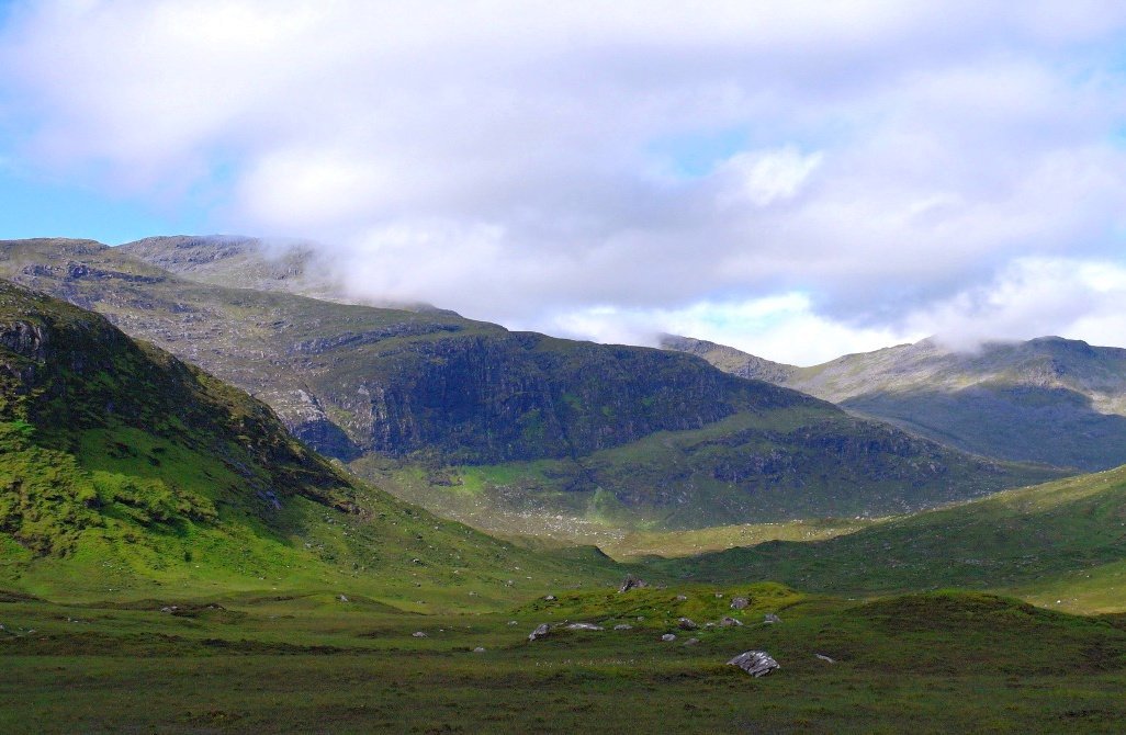
(Pictured here) The hills of Harris, on a bright morning, as we travelled up to Lewis. Forgive me for starting the Isle of Lewis page with a Harris picture. As noted above, it’s the same island really, basically ‘Lewisnharris’.
So, if Harris is hill and rock, Lewis is peat and moor. Lewis has got interesting places for visitors, plus the largest town, Stornoway, which has good transport links, both by ferry and air.

Stornoway on a Sunday
(Pictured here.) Stornoway on a Sunday. Deserted, except for the churchgoers’ cars parked in the pedestrians-only zone. The traffic lights are the only working thing here.
Oh, but The Boatshed Restaurant in The Royal Hotel, Cromwell Street did us a delicious dinner.
As far as I know, its coffee machines have not yet been struck by a bolt of retaliatory lightning for breaking the Sabbatarian edict that can still be found in operation here, almost uniquely in Scotland.
In fact, there isn’t an awful lot to say about Stornoway itself.
It reminds me of an east rather than a west coast small town in Scotland, with some fine solid town-houses and civic buildings that owe their origins to fishing or fish-curing money back in the 19th or early 20th century.
Its got a reasonable range of shops and is well worth a stroll about. There’s a dining choice too, with the Harbour Kitchen getting mentioned quite a lot.


Lews Castle overlooks the town. This Victorian mock-tudor edifice was built by Sir James Matheson in 1847.
He made his money in the Chinese opium trade. (Yes, unsavoury. I thought so too – but he did implement various schemes to mitigate poverty on the Isle of Lewis – assisting emigration was a large part of his “improvements”) There are attractive grounds and parkland, open to all.
The totally restored Museum nan Eilean is in the Castle grounds.
The new-ish museum is excellent. Don’t miss it as it sets the scene for your Lewis explorations – and it has a nice cafe and tasteful shop too.
You can also stay here in the restored castle self-catering apartments. Stornoway has a good range of accommodation – but book in advance in the main season, as this is a busy island!
Standing Stones of Calanais on the Isle of Lewis
But, let’s face it, Stornoway is the sort of place from which you pass through and disperse outwards to the islands’ other points of interest. (Ooh, I feel a metaphor; ‘The Athens of the Hebrides’ welling up.)
And one of these places, of course, is the Standing Stones of Calanais, sometimes referred to as ‘Scotland’s Stonehenge’. I do hope Stonehenge is sometime described as England’s Calanais.
As they are 5000 years old, they don’t give much away. This is advantageous because it means whatever theory you have or believe about the stones, then it is as likely as any other.
‘Unknowably ancient’ is what I used to write in the brochures. Sounds a bit ponderous. Or pompous, but, there, I’ve gone and written it again.

The Calanais Standing Stones, as seen through heather-tinted spectacles. (indulge me here, please.) Can’t begin to tell you how long I had to wait until all the visitors that day were hidden behind the stones. Popular place on the Isle of Lewis.

Pictured here: The Calanais Stones visitor centre. Everyone photographs the Stones to death, but in this picture the stones are immediately behind me.
And it’s a very nice visitor centre, well done Historic Environment Scotland.
There are other megalithic settings in the vicinity.
My belief is that the people who erected the Calanais crucifirm setting (‘coughs authoritatively’) 5000 years ago were out of their heads on heather ale one Saturday night and, for a laugh, set all these stones up on end.
Somehow they knew that this arrangement at Calanais would be the one that would eventually have a very nice visitor centre, cafe and shop on the site. (And those Harris tweed bags are just so tempting…)
You see, my theory is that the stones were used for foretelling the future…oh, stop it.
Mysterious Brochs Of the Isle of Lewis
Onwards to…well, it’s a Lewis mini tourist trail really. You could hop over to the Dun Carloway broch. This also is a place where you speculate about what brochs were about.
Circular dry-stone structures, unique to the north and west of Scotland, the earliest brochs are a little bit BC and they were built into the first few centuries AD.
These Iron Age buildings are thought to be high status – if you were big in iron, especially in sharp pointy things like spears, you built yourself a broch, perhaps.
Go to my Rousay, Orkney page if you want my own broch theory. I think they were community centres or maybe just sheltered housing for the less able warriors.
More sensible people think they were places of defence from sea-borne raiders. Heck…who knows?

The Gearrannan Blackhouse Village on the Isle of Lewis
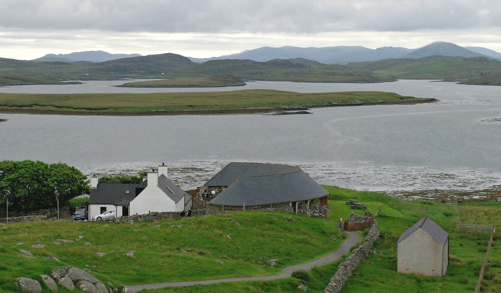
Lets move on just a short way to the Gearrannan Blackhouse village.
This is about as close as you are going to get to a notion of what hundreds of settlements in the Hebrides must have been like, in the days of the blackhouse – the stone built, thatched dwellings of the local folk.
The last elderly folk here only moved out in the 1970s and the wee village was preserved and is now renewed, refurbished, re-thatched, replumbed, re-everythinged really.
Obviously, it’s all sanitised – after all, the interiors of some have even become plush self-catering units, and there’s a hostel too, but with a little imagination…

(Pictured) In the olden days of photography, / the world was kind of sepia, / with a very gloomy ambience / that often made people weepia. Sorry. I’ll see myself out.
Yes, this photo was, of course, taken just the other day – or June 2014 – gosh, doesn’t time fly? – but 21st-century Gearrannan looks very authentic when sepia tinted?
(Sometimes these photo-editing tools just go straight to your head…)
Anyway, go along to this curious place: the Trust needs your support. It’s a really worthwhile visit. Just as good as Calanais. Say hello to Roddy the weaver as well – he’s got a lot of stories to tell.
And I’ll always remember it for a unique culinary event in the cafe. It was the first time I ever ate a white pudding roll. Imagine – a mealy pudding in a bap.
Oatmeal and refined carbohydrate. It’s an Aberdonian’s taste ecstasy. Oat cuisine (sorry, compulsory pun) at its finest.
Further north still, Historic Environment Scotland care for another black house, at Arnol. The last time I was there, it was a lot smokier than the Gearrannan houses, so it is probably even more authentic.
Remember that in these early dwellings, the peat smoke just found any old way out of the roof – there were no chimneys as such.
And often there wasn’t much separating the animals from the human occupants. Goodness, it must have been a rich olfactory experience altogether. (Said the vicar.)
The tallest standing stone in Scotland
Further north across the rolling peatlands –
Well, let’s keep going on our Isle of Lewis road-trip. Gosh, it’s getting a bit sparse now. Still plenty of houses though, from place to place.
Fine, comfortable, even stylish looking, buildings, many new, with the old blackhouse at the end of the plot or garden often re-roofed in ‘crinkly tin’ (corrugated sheeting) as a store or an office or a studio. My, how times change…

(Pictured here.) The Clach an Truisiel (sometimes anglified to ‘Trushal’) is also in this section of the journey north.
It’s the tallest standing stone in Scotland.
And that’s about all you can say. I mean, Johanna is pretty tall, but look at the size of that monolith.
The crofts run down to the Atlantic edge, the moor and grassland run off to the far horizon…the peewits call mournfully…and the stone has heard them for five millennia.
The Clach an Trusiel Stone also features in the facts about Scotland page.
Later that same day…another little crest on the road…another sign for an art gallery. This one, in particular, was for the Morven Gallery, away, far away, on that endless road. (Och, stop being dramatic. Get a grip.)
And there goes that phenomenon again: just when you thought what a tedious and gawd-forsaken skelp of peatland all this was becoming: suddenly you can be tempted by lovely creative artwork and great coffee and cakes.
The Outer Hebrides never cease to amaze me.
Around The Butt Of Lewis
– The End Of The Outer Hebrides
Finally, the Hebrides stop. Not suddenly, at huge vertiginous cliffs, but sort of quite suddenly at middle-sized vertiginous cliffs (Pictured – below- small here).
If you care to walk from Port of Ness to the Butt of Lewis lighthouse, you’ll see for yourself.
Again, surprises, if you haven’t been studying your map. There’s a lot of settlement towards Ness or, more accurately Port Nis. There is stuff going on: a football social club, and football pitches, where the training team members call for the ball in Gaelic. Brilliant.
It’s a pity that some are so gloomy abut the future of the Gaelic language.
And, if you have been expecting only to see a stunted inhabitant or two, hanging on to the heather by their fingernails, before being blown into the Atlantic by the wind, then, well, it isn’t like that at all.

Admittedly, the Butt of Lewis, by the lighthouse, has the reputation for being the windiest place in Britain, but there are calm days too. The pictures here prove the weather on that occasion.
I sunbathed at the lighthouse on a warm June day and even took a selfie to prove it.
The picture looked so spectacularly awful though that you’re just going to have to take my word for it.
There are beaches on the Atlantic side, though if you’ve just come up the entire length of the Outer Hebrides, you may have seen enough.
One of the nearest to Ness, Traigh Shanndaigh, is very attractive and there is grand coastal walking in plenty hereabouts.
(Pictured here) Europaidh from Traigh Shanndaigh – basically, the last settlement before the Butt of Lewis from the last beach. Yet another all but deserted shoreline!
From Vatersay, south of Barra, to here near the northern tip – extraordinary beaches all the way.

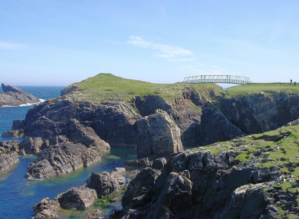
I mentioned the coastal walk from Port of Ness to the lighthouse already. This goes past Dun Eistean. It’s an offshore very rocky tidal islet and a natural place of defence. It was in mediaeval times a stronghold of the Morrisons.
It was investigated for its archaeology and then in 2002 a wee bridge was built, linking the islet to the mainland.

(Pictured here) Dun Eistean and the pointless bridge. Still, a fine bit of coast.
Though there’s really nothing to see by way of recognisable structures, there is an excellent information board at the mainland end of the bridge.
If you go across the bridge in the summer, then Arctic terns will attack your head. The board mentions this and it’s true. I immediately turned back.
And, as I am not a Morrison, I admit my sympathies are all with the terns.
Imagine, nesting there for generations in peace, fairly safe from predators, and then somebody comes along and builds a completely pointless bridge. Sheesh.
I mean, terns have a tough enough time anyway as ground nesters by the coast, with disturbance by dog walkers and other coastal footpath users – and now the Clan Morrison!

The Butt of Lewis Lighthouse
(Pictured above) The Butt of Lewis Lighthouse, lit in 1862. A David Stevenson light.
So, here, at last is the lighthouse. No whales on this occasion, though I have seen them here in the past.
And here we must leave you at the top end of the isle of Lewis in the Outer Hebrides. I’d definitely do it south to north, if I was touring by car. That way the sun will be at your back.
And you will see the sun, I promise. (Almost.)
More information on individual islands of the Outer Hebrides or Western Isles here. From the south going north: Barra, Eriskay, the Uists and Benbecula and Harris.